Web desk
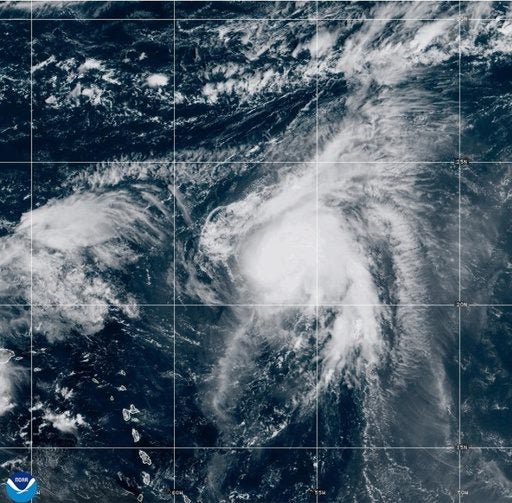
Hurricane Humberto rapidly strengthened into a powerful Category 4 storm over the Atlantic Ocean on Friday, with forecasters warning that the Portuguese archipelago of the Azores could face strong winds, heavy rainfall, and dangerous surf in the coming days.
According to the U.S. National Hurricane Center (NHC), Humberto is now packing sustained winds of more than 130 mph (209 km/h).
While its exact track remains uncertain, meteorologists say the storm is moving east-northeast and could approach the Azores by early next week.
Local officials in the islands have begun preparations, advising residents to stay alert for possible evacuation notices or emergency updates.
Large swells generated by Humberto are expected to reach parts of the North Atlantic, increasing the risk of coastal flooding and rip currents.
The storm’s impact could be further complicated by the presence of Tropical Storm Gabrielle and Tropical Storm Narda, both of which are active in the Atlantic and contributing to unstable weather patterns.
The 2025 Atlantic hurricane season has already produced multiple strong systems, highlighting concerns among climate experts about rising ocean temperatures. Warmer seas are known to fuel hurricanes, making them more intense and increasing the likelihood of rapid strengthening events such as Humberto’s.
The Azores, a group of nine volcanic islands located about 1,000 miles west of Portugal, are no strangers to tropical storms, though direct hits from Category 4 hurricanes are rare. Authorities say advance warnings and monitoring systems have improved in recent years, giving islanders more time to prepare.
Meteorologists caution that even if Humberto does not make a direct landfall, the islands could still experience storm-force winds, heavy rainfall, and hazardous marine conditions.