A potentially strong El Niño is taking shape in the Pacific, and governments are already being warned to prepare for floods, droughts, heatwaves and food-security shocks before the pattern fully settles in.
The latest outlook from the U.S. Climate Prediction Center says El Niño is likely to emerge between May and July 2026, with an 82% chance of development during that period. Forecasters also say there is a 96% chance it will continue through the Northern Hemisphere winter of 2026–27, when El Niño events often reach their strongest phase.
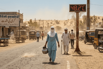
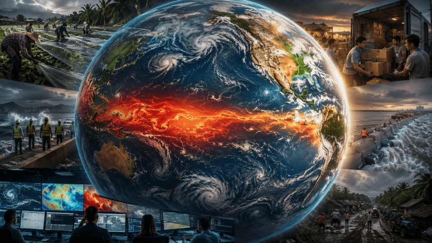
This is not just another weather update. El Niño can reshape rainfall and temperature patterns across large parts of the world. In some regions, it brings heavy rain and flooding. In others, it can worsen drought, damage crops, raise wildfire risks and push already hot conditions even higher.
The concern is growing because early indicators are pointing toward a potentially powerful event. A recent strength outlook showed that by November 2026 to January 2027, there is a combined roughly two-in-three chance of a strong or very strong El Niño. That does not guarantee a “super” event, but it is enough for disaster agencies, farmers, water managers and energy planners to start paying attention now.
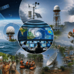
The World Meteorological Organization has also warned that the likelihood of El Niño is increasing from mid-2026, with expected impacts on global temperature and rainfall patterns. These forecasts are not issued just for scientists. They are meant to give countries time to prepare — especially those already vulnerable to extreme weather, crop losses or water shortages.
El Niño begins in the tropical Pacific, when sea surface temperatures become warmer than normal across parts of the central and eastern ocean. That warming changes atmospheric circulation, and the effects can ripple far beyond the Pacific. It can influence monsoon behavior, storm tracks, drought zones and even global average temperatures.
For the Atlantic hurricane season, the expected El Niño may actually reduce storm activity. U.S. forecasters are projecting a below-normal 2026 Atlantic hurricane season, with 8 to 14 named storms, 3 to 6 hurricanes and 1 to 3 major hurricanes. El Niño often increases wind shear over the Atlantic, which can tear apart developing storms before they strengthen.
But that does not mean the world gets a break. A quieter Atlantic can come with trouble elsewhere. El Niño years can raise risks of extreme heat, flooding in some regions, drought in others, and more active storm conditions in parts of the Pacific. That uneven pattern is what makes El Niño so difficult to manage: one country may be preparing for too much rain, while another is bracing for failed crops.
Agriculture is one of the biggest concerns. Even a moderate El Niño can disrupt food systems by affecting rice, wheat, maize, palm oil, sugar and other key commodities. A stronger event could add pressure in countries where food prices are already sensitive and farmers rely heavily on seasonal rains.
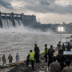
Water authorities are also watching closely. In drought-prone regions, reservoirs, irrigation systems and hydropower supplies can come under strain. In flood-prone areas, officials may have to prepare drainage systems, reinforce embankments and improve early-warning alerts before the heaviest rains arrive.
Health systems could feel the impact too. Hotter conditions can increase heat stress, while floods may raise the risk of waterborne disease. In some tropical regions, shifts in rainfall and temperature can affect mosquito-borne diseases as well. That is why El Niño is increasingly treated not only as a climate event, but as a public-safety issue.
There is still uncertainty. Forecasts can change, and the final strength of an El Niño event depends on how ocean and atmospheric conditions evolve over the next several months. But the signal is strong enough that many countries are not waiting for certainty.
The message from forecasters is fairly clear: El Niño may not be fully here yet, but the preparation window is open.
And if this one becomes strong, the countries that act early will have a far better chance of limiting the damage.