An intense wave of heat is beginning to take hold across parts of the eastern United States, marking the first phase of a two-part extreme heat event. This oppressive pattern will pave the way for a powerful, far-reaching heat dome expected to push temperatures to dangerously high, potentially record-setting levels over the weekend and into next week.
The National Weather Service has placed more than 15 million people stretching from the Washington, D.C. area down to portions of Florida under a significant level 3 out of 4 heat risk through Thursday. Officials caution that this level of heat can be hazardous to anyone lacking proper cooling or hydration.
Daytime highs in many areas will range from the low to mid-90s, but the oppressive humidity will make it feel much hotter, with the heat index soaring into the triple digits. The muggy conditions will not only intensify the heat but also reduce overnight cooling, making recovery more difficult.
This early summer heat surge is being fueled by a high-pressure system positioned over the western Atlantic. It’s pulling hot, moisture laden air from the Caribbean northward, creating stifling conditions. The tropical origin of the air mass is contributing to the overwhelming humidity and prolonged discomfort.
Thursday’s most intense heat will target Virginia and the Carolinas, but rising temperatures are also expected throughout the Northeast and central U.S., setting the stage for an even more severe heat event next week.
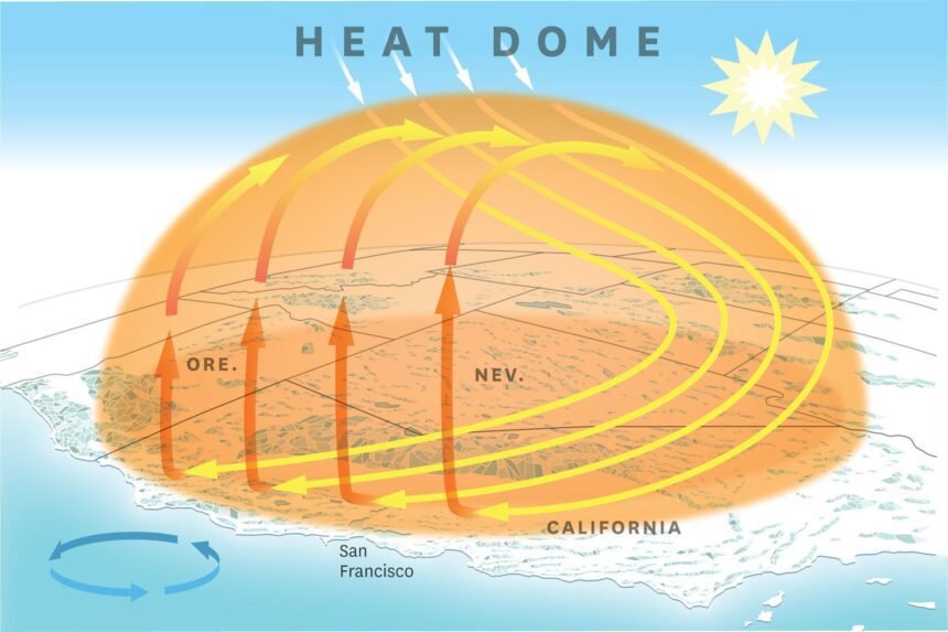
As the weekend approaches, the heat dome is expected to expand across the central and eastern regions of the country stretching from the southern Plains through the Midwest, Mid Atlantic, and Northeast. Temperatures in these areas will surge at least 15°F above seasonal averages, with widespread highs in the upper 90s and a heat index that could reach a sweltering 110°F, especially in the Mid-Atlantic.
By early next week, a level 4 out of 4 extreme heat risk indicating rare, long-lasting, and potentially deadly conditions will take hold in several major cities, including St. Louis, Chicago, New York City, and Washington, D.C.
The central U.S. will feel the brunt of the heat starting Friday, with Denver expected to tie a record at 101°F. Chicago will face the heat this weekend, with forecast highs of 95°F on Saturday and 96°F on Sunday.
Early next week, the Northeast and Mid-Atlantic will experience their hottest days of the year. New York City is forecast to hit 95°F and 96°F on Monday and Tuesday, nearing historical records. Washington, D.C. could reach 100°F both days, threatening daily temperature records. Boston is also expected to see highs of 92°F and 94°F, just below records from the mid-1990s.
On Monday and Tuesday alone, more than 150 daily temperature records may fall including both daytime highs and overnight lows at weather stations with data dating back over a century.
Heat remains the most lethal form of extreme weather in the U.S., contributing to more than 800 deaths each year since 1999, according to a 2023 study.
Even in areas accustomed to summer warmth, sustained periods of extreme heat can lead to serious health risks. Emergency departments report spikes in heat-related illnesses on high risk days, particularly when high humidity and warm nighttime temperatures prevent the body from properly cooling.
Climate change is exacerbating this risk, as overnight temperatures are rising faster than daytime highs. This trend makes it more difficult for people to recover during the night, increasing the likelihood of heat-related illness and death.