September 26, 2025
Web desk
Tropical Storm Humberto has now strengthened into a hurricane, according to the latest update from the U.S. National Hurricane Center (NHC). With maximum sustained winds of 75 mph, the system is gaining momentum over the Atlantic, and forecasters warn that it could rapidly intensify into a major hurricane by the weekend. For now, there are no coastal watches or warnings in effect, and current models suggest Humberto will remain out at sea.
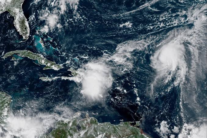
Meteorologists are also closely tracking unusual atmospheric activity that could bring rare interactions between storms. Experts say a “Fujiwhara effect”—when two cyclones rotate around each other—is possible if Humberto comes close to another system. Hurricane Gabrielle, which has already transitioned into a post-tropical cyclone but is still carrying strong winds, and Invest AL94, a developing disturbance near the Bahamas, are both being monitored for potential interaction.
The NHC reports Humberto is moving slowly in weak steering currents, gradually shifting west-northwest while showing signs of rapid intensification. Forecast models indicate it will continue strengthening as it pushes further into the Atlantic. At the same time, Invest AL94 could soon form into a tropical depression or storm, with a chance of being named Hurricane Imelda if it develops fully.
Heavy rainfall and possible flooding are expected in parts of Puerto Rico, the Dominican Republic, Haiti, and the southeastern Bahamas as AL94 moves across the region. By this weekend, the system is expected to pass near the Bahamas before turning northward toward the U.S. east coast. While its future track remains uncertain, forecasters warn that the risk of wind, rain, and storm surge impacts for the southeastern United States is increasing as the active Atlantic hurricane season continues.