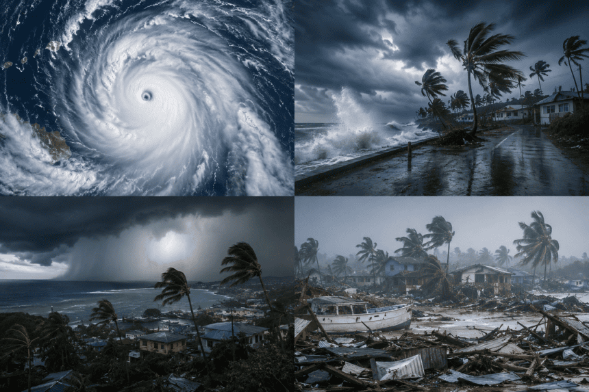
Guam faces a direct, potentially catastrophic strike from Super Typhoon Mawar as the category 5 storm barrels toward the U.S. territory. Forecasters warn of life-threatening winds and a dangerous storm surge that could devastate the island’s infrastructure.
Governor Lou Leon Guerrero ordered residents in low-lying, coastal, and flood-prone areas to evacuate immediately. The storm is packing sustained winds of 150 mph, with gusts pushing well beyond that. It is the most powerful storm to threaten the island in two decades.
The National Weather Service has issued an extreme wind warning, advising residents to stay indoors and away from windows. Officials expect the eye of the storm to pass over or very near the northern tip of the island late Wednesday or early Thursday.
Emergency shelters are at capacity. Power grid operators warn of prolonged outages, as the island’s aging electrical infrastructure remains highly vulnerable to the projected wind speeds. The military has shifted its naval assets out of the harbor to avoid damage, leaving the civilian population to weather the brunt of the impact.
This storm isn’t just about the wind. Rainfall totals could reach 25 inches in some areas, triggering flash floods and mudslides across the island’s mountainous terrain. The geography of Guam leaves residents with little room to maneuver once the outer bands arrive.
While the island is accustomed to tropical cyclones, the intensity of Mawar is different. Meteorologists noted the storm underwent rapid intensification—a process where the pressure drops and wind speeds jump in a matter of hours—making it difficult for local emergency services to adjust preparation timelines.
The danger won’t end when the winds die down. Downed power lines, blocked roads, and flooded homes will create a complex recovery effort that could last for weeks. For now, the island waits in the dark, hoping the storm tracks even a few miles further north than currently projected.