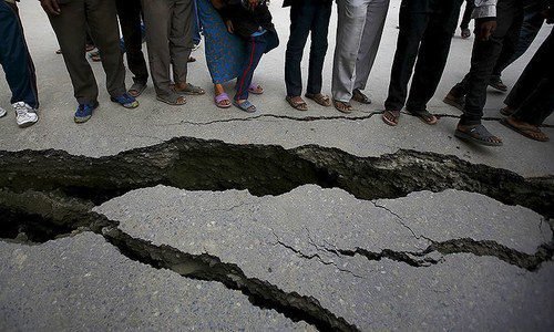
Karachi trembled once again on Saturday morning as a 3.2 magnitude earthquake struck Malir, Landhi, and nearby areas at about 9:53 AM. According to the Seismological Center, the tremor’s epicenter was 12 kilometers north of Malir and it struck at a depth of 35 kilometers.
The Karachi region has felt 39 low to mild quakes since June 1, reflecting ongoing activity along its fault lines. Chief Meteorologist Ameer Haider explained that these tremors are a result of energy release at the Landhi Fault Line, adding that their intensity is expected to diminish in the coming days.
Officials confirmed there were no reports of damage from the shock, noting it was a weak tremor and part of a series of minor quakes frequently occurring in the area. “Historically, the Landhi Fault has not produced any major earthquakes,” a representative said.
Meanwhile, a study by Nanyang Technological University in Singapore highlights land sinking in Karachi’s Landhi and Malir at nearly 15.7 cm between 2014 and 2020 — the second fastest rate of land subsidence in the world after Tianjin, China. The study attributes this to groundwater extraction and the proliferation of high-rise buildings, adding pressure to already vulnerable land.
The city lies at the convergence of the Indian, Eurasian, and Arabian tectonic plates, adding to its susceptibility to earthquakes. Scientists warn that if groundwater usage and heavy construction continue unchecked, more areas could sink and become prone to future tremors.
The study advocates for policy intervention, including desalination plants to ease pressure on underground water and tighter controls on high-rise projects in vulnerable districts. Earlier reports to a Senate body in 2015 also raised alarm over coastal areas of Badin and Thatta, which may become submerged in the next 30 years if protective measures are not taken.