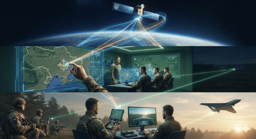
Ukraine’s drone operators are no longer flying blind. By bridging commercial satellite constellations with battlefield intelligence, Kyiv has turned the sky into a real-time tactical map. It’s a shift that has fundamentally altered the pace of the conflict, moving drone warfare from sporadic scouting to surgical, persistent targeting.
At the center of this integration is the rapid transmission of high-resolution imagery. Systems like Starlink provide the connectivity, but the eyes in the sky come from an array of private satellite operators. These companies supply synthetic aperture radar (SAR) and optical data that can pierce through cloud cover and darkness. When a drone unit identifies a Russian armor column or a logistics hub, that data isn’t just sitting on a tablet; it’s being cross-referenced with satellite feeds to confirm movement, elevation, and terrain constraints.
This isn’t just about spotting targets. It’s about precision logistics. Drone pilots, often operating from cramped, makeshift bunkers, use satellite-linked software to calculate wind speed, battery drainage over specific topography, and optimal flight paths to avoid electronic warfare jamming zones. By layering satellite data over drone sensor feeds, operators can navigate “dead zones” where GPS signals are routinely spoofed by Russian systems.
The military impact is measurable. Analysts tracking the conflict note that Ukrainian forces have moved away from the “spray and pray” approach common in the early months of the invasion. Instead, they rely on a constant loop of information. A satellite spots a change in a trench line; a drone is dispatched to verify; a strike is authorized within minutes. This cycle—the “sensor-to-shooter” loop—has decimated high-value Russian assets that previously relied on terrain masking for protection.
Critics and military theorists have debated the ethics of involving private tech firms in active combat, but the reality on the ground is stark. For the Ukrainian military, these satellites aren’t just tools; they are a substitute for the heavy reconnaissance aviation they lack. They provide a level of situational awareness that was once the exclusive domain of superpowers.
Russia has attempted to counter this by targeting ground stations and attempting to jam satellite links, but the decentralized nature of these constellations makes them difficult to fully neutralize. The network is too broad and the data flow too fluid to be stopped by traditional kinetic strikes.
As the frontline stagnates, the war has become an intelligence contest. Kyiv’s ability to maintain this satellite-drone synergy ensures that even as the infantry digs in, the threat from the air remains constant, precise, and lethal. The next phase of the conflict won’t be decided by armor alone, but by who can process the view from 300 miles up the fastest.