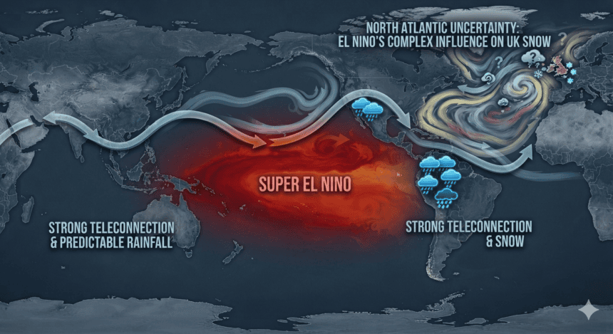
The Met Office isn’t making any promises, but the return of El Niño has reignited the annual debate over whether the UK is in for a brutal winter. While the climate phenomenon is traditionally associated with warmer global temperatures, its impact on the British Isles is far more complex than a simple “yes” or “no” to snow.
El Niño—the periodic warming of surface waters in the central and eastern Pacific—alters atmospheric circulation patterns thousands of miles away. In the UK, the primary concern isn’t just the Pacific temperature; it’s the knock-on effect on the North Atlantic Oscillation (NAO).
When the NAO shifts into its negative phase, it weakens the jet stream. This allows cold, polar air to spill south, often stalling over Northern Europe and the UK. If the stars align, this creates the classic “Beast from the East” scenario. However, the data remains frustratingly split.
“El Niño tends to favor a milder, wetter winter for the UK,” says one senior climatologist. “The jet stream usually stays strong and zonal, driving mild Atlantic air across the country. It’s the opposite of what people hoping for a white Christmas want to hear.”
But history shows that El Niño isn’t a singular dictator of British weather. The winter of 2009-2010, one of the coldest on record, occurred during an El Niño event. The difference? A sudden stratospheric warming (SSW) event disrupted the polar vortex, effectively tearing up the rulebook for the season.
The Met Office’s latest long-range outlook suggests the UK should prepare for a volatile season. While the baseline expectation remains “mild and wet,” the agency acknowledges that the breakdown of the polar vortex remains a wildcard. If that vortex fractures, the mild Atlantic influence collapses, and the door swings open for Arctic air.
For the average Brit, this means the risk of a severe cold snap hasn’t disappeared—it’s just become less predictable. We aren’t looking at a guaranteed freeze, but we are facing a winter where the margin between a soggy, grey December and a week of paralyzing snow is thinner than usual.
As for the snow, don’t clear the driveways yet. The meteorologists are watching the stratosphere, not just the Pacific. Until the polar vortex shows signs of instability, the forecast remains locked in a familiar, uncertain holding pattern.